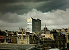
Vladimir wrote:High rise on the right looks like those at Cowcaddens, is that not the M8


Vlad, your pic has one of the Dundasvale towers in it - to the left of the Cowcaddens and the pic was taken from the footbridge on Garscube Rd. Phoenix Rd runs under the motorway - to the right - in the pic and heads towards St.George's X with a slip road veering to the left to join the M8 (If my memory serves me correctly)
In the B & W pic that is Phoenix Rd the mini is on and coming from Cowcaddens/Garscube Rd. The cooling tower is Pinkston power station near Sighthill (seen in the distance) and Spier's Wharf can be seen between the tenement (demolished late 70's) and the cooling tower. There used to be a Woolworths across the road from the tenement (useless trivia I thought I'd throw in!)
The pedestrian sign definitely said Garnethill but I'm racking the sawdust to remember the bottom line - it should say Charing X - and with an X - not 'cross'.