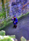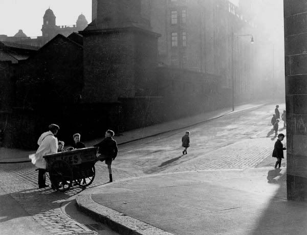
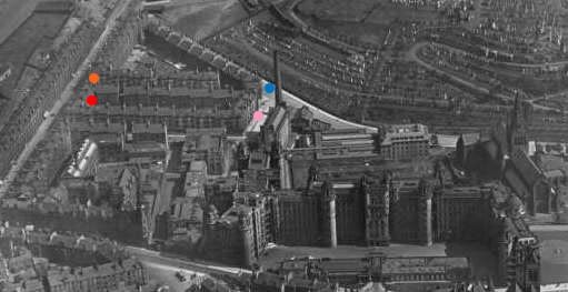
Gizzi, the ice-cream man, Glasgow.
Guiseppe Gizzi, with his ice cream barrow at the corner of Wishart Street, James Orr Street and Glenfield Street, around 1937. His sales pitch covered miles of streets in Glasgow's east end where he pushed his barrow daily, switching in the winter to roasted chestnuts. The building behind the barrow is the boiler house of the Glasgow Royal Infirmary.
IMAGE AND TEXT © John Kraska Collection:
http://www.tones.demon.co.uk/Mac/index.htm
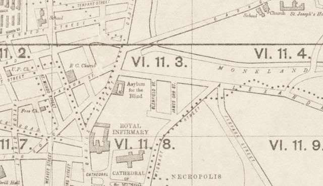
I had a look for Glenfield St. and turned up the following:
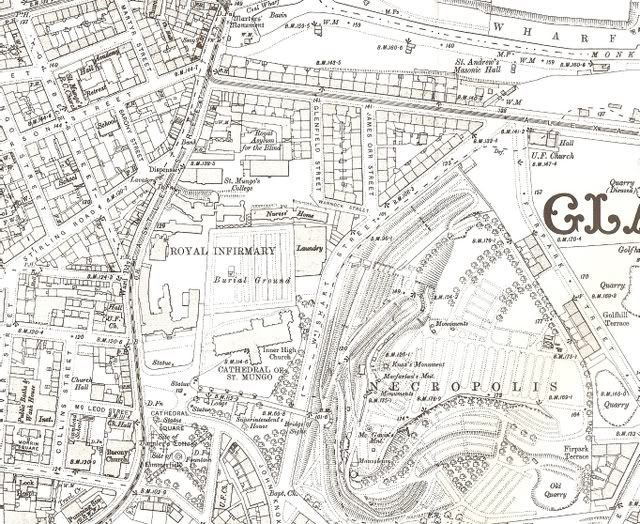
Town Plan 1892-94:
1930's:
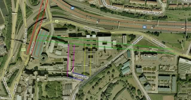
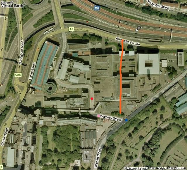
Glenfield St. is the one marked with the red dot, it exits onto Warnock St. (pink dot) which in turn exits onto Wishart St. (blue dot)
James Orr St. is the one dotted in Orange, it exits onto Wishart St.
The top ends of Glenfield St. & James Orr St. would exit onto Alexandria Parade.
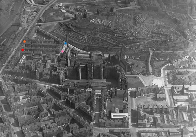
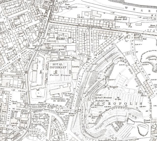
In the 'Gizzi, the ice-cream man' photo by Andrew MacDonald, the pov would seem to be looking directly up Warnock St. The 'cobbled’ exit from James Orr St. can be seen at bottom right. At first I thought that Glenfield St. originally doglegged onto what later became Warnock St. But looking at this map from 1909, it would seem that Warnock St. was already in existence.
So, is the photograph caption is wrong?
The boiler house chimney stack can be seen in both photographs.
1909 Map:
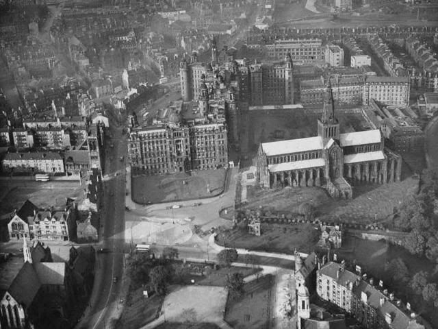
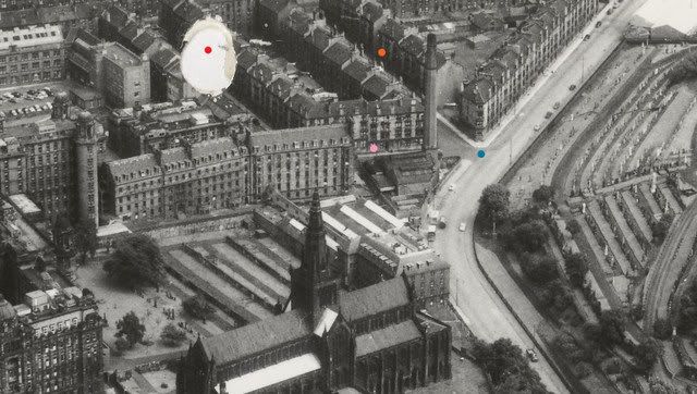
Another view from 1933
Early / mid ‘60s (Same dot ref)
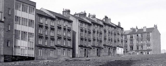
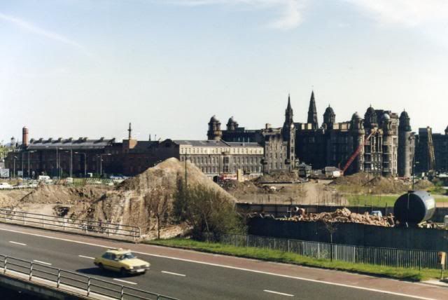
By an amazing co-incidence, this photograph surfaced on another Glasgow site the other night. It was taken by 'Kev9' sometime during 1983/4. Apart from the hospital and the Blind Asylum immediately to it's left, everything else has gone. The low building with the cream top storey is now the multi storey car park. To the rear can be seen what is left, if anything, of the Glenfield St. area, it's too difficult to pick out the details on the buildings, the boiler house chimney stack is there as a ref.
I’m not sure when Glenfield St. & surrounding areas were demolished but the new building would appear to have been completed in 1983:
Since 1974, the Greater Glasgow Health Board had envisaged the replacement of the original buildings with a brand new hospital, but only the first phase of this was ever realised - the New Building was completed in 1983. It is located on the north of the hospital site overlooking Alexandra Parade and the M8 motorway, and is linked to the Surgical Wing of the original Royal Infirmary building at basement level via a link corridor, with a further pedestrian entrance at lower basement level on Wishart Street (adjacent to the Necropolis).
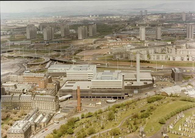
This was the area post modern extension but pre multi storey car park:
(use the boiler house chimney stack as a ref point)
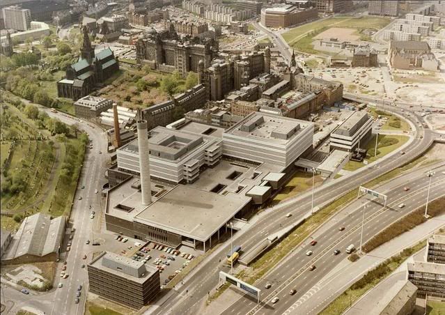
2001 / 2002
After the closure of the Rutherglen Maternity Hospital and the Glasgow Royal Maternity Hospital, a new maternity building was added to the east of the New Building; the Princess Royal Maternity building opened in 2001. Following the closure of Canniesburn Hospital, in 2002 the Jubilee building was opened, adding purpose-built Accident & Emergency facilities and a plastic surgery unit. The Infirmary now has over one thousands beds.
Hospital site plan:
http://library.nhsggc.org.uk/mediaAsset ... te_map.pdf
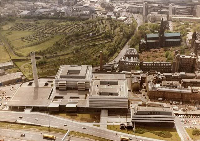
2004:
An evaluation was carried out in August 2004 in advance of a proposed car park. Numerous building foundations were identified, dated to the 19th century, many on the 1st edition OS map. A tunnel or drain, most likely related to the Monklands Canal Basin, constructed by 1782 and located to the N of the area, was identified in the northern part of the development area.
No original ground surfaces were identified, and it would appear that there has been extensive landscaping and terracing over the entire area. As a result, no remains dating to before the 18th or 19th centuries were identified.
Here is a modern view from 'Windows Live Local' I think that part of Glenfield St. may still partially exists as a thoroughfare. James Orr St. I would guess to have been where the orange line runs (perhaps a tad to the right). All of the new buildings are in place and the multi storey can be clearly seen. Sadly, the boiler house chimney stack has gone too
An aside on ‘Gizzi’ from ‘jimmyd’ over on ‘The Glasgow Guide’
Ross, re the pic of the Ice Cream man on Andrew McDonalds site. Well he lived in Bridgeton, I went to school with his kids,his cafe was in Main St ,next to the "Wee Royal" picture house, to put things into perspective,in that pic, he was up near the Royal Infirmary. So he has walked there, all the way from Bridgeton, up all those hills pushing a barrow. Funny thing!! the ice cream man is just passing as I write. Joe Gizzi's barrow did not play Greensleaves !!
http://discuss.glasgowguide.co.uk/lofiv ... p/f18.html
I’ve no doubt that some of the dates & opinions stated above will be in need of correction, please feel free to add any info you may have.
NB: Aerial colour photos courtesy of My Kitten.