AMcD wrote:Excellent map Glesga_Steve.
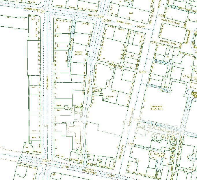
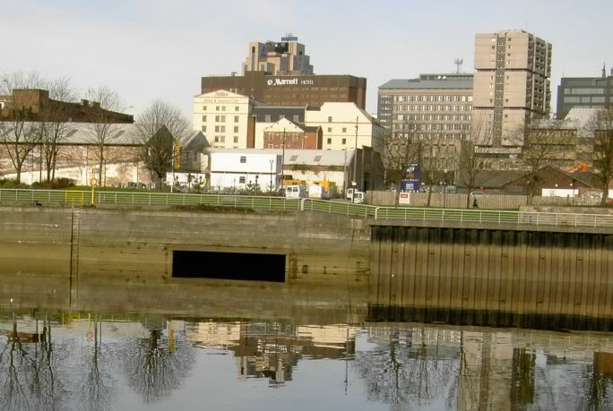
I'd always wondered what this was that runs into the Clyde next the Ferry at the Broomlielaw.
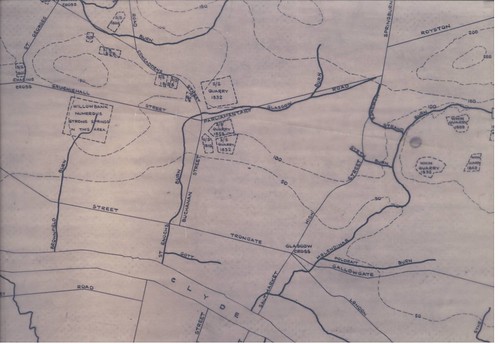
Looks like it's the Brownfield Burn.
I'm fairly sure that the Brownfield Burn doesn't exist any more - in the 15 years I've been in my job, I''ve never come across any reference to (or evidence of) it other than on the plan that I uploaded. In saying that, I've never had any reason to try to establish whether it still exists or not so I haven't went looking for references / evidence.
The photo you uploaded looks like the outfall from the CSO (combined sewer overflow) at the junction of Broomielaw / McAlpine Street. I have always suspected that the sewer in McAlpine Street may originally have been the culverted Brownfield Burn. This theory is largely fuelled by two factors - (i) the Brownfield Burn joined the Clyde in the general vicinity of where McAlpine Street is now; and (ii) the sewer in McAlpine Street is unusually large, in fact I'm sure from memory it's by far the biggest sewer in the city centre area.
There are a lot of CSO outfalls to the Clyde between Glasgow Green and the SECC - one at almost every road junction along Clyde Street / Broomielaw / Anderston Quay / Lancefield Quay. The reason there are so many is due to the fact that all the sewers that run from the city centre / Anderston area towards the Clyde used to discharge straight into the river. In the late 1800s/early 1900s a new trunk sewer (the Glasgow Interceptor) was laid east to west along Clyde Street etc to intercept the flows in these older sewers and (simplifying the sewerage layout here but...) drain them towards Dalmuir Sewage Treatment Works (in Clydebank). At the junction with each intercepted sewer, however, a CSO was built to allow excess flows to be discharged to the river, through the original outfall, during storm conditions.
If you were to walk along the south bank of the Clyde at low tide you would be able to see all the CSO outfalls. Similarly, if you were to walk along the north bank you would be able to see the same sort of set-up on the south side of the river - though there aren't quite as many on the south side.
I'll upload plans of this area over the next few nights to show the position of these CSOs.