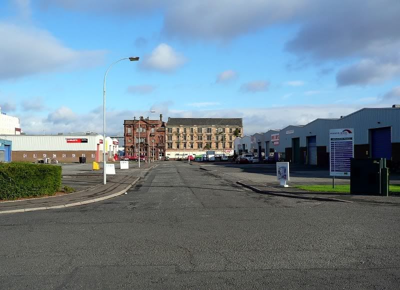
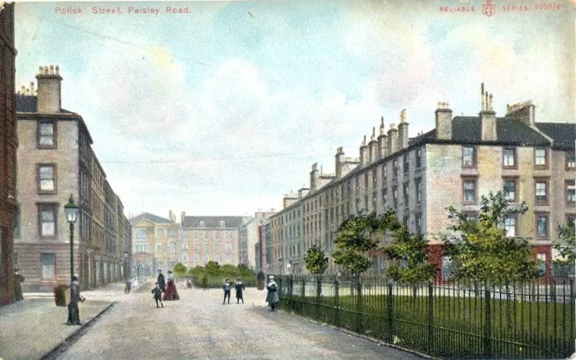
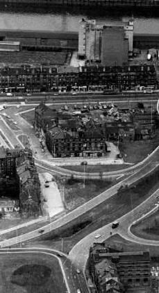
I came across this interesting feature in Pollok St, Kinning Park / Kingston: (Scotland St. School at bottom of the street)
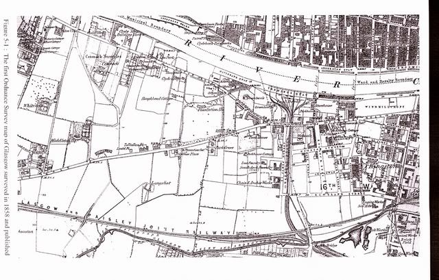
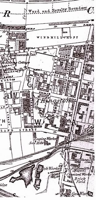
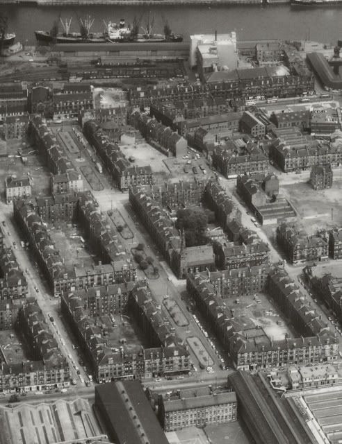
I looked out an old aerial photograph I have of the area (circa 1960) and sure enough, there they were,
a beautiful collection of individual gardens running the full length of the street:
At the top of the street to the left stood the UP Church & at the bottom of the middle block on the same side,
stood the Maxwell Parish Church, see below for further information on both. Scotland St. School lies at the bottom of the street.
The Virtual Mitchell (as ever) threw up some very nice photo’s of the gardens:
C8926 / 2-26 Pollok St, Date 25 Oct. 1964 (Demolished)
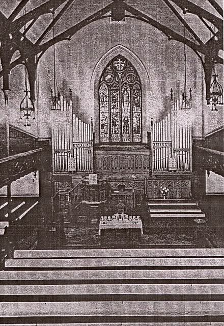
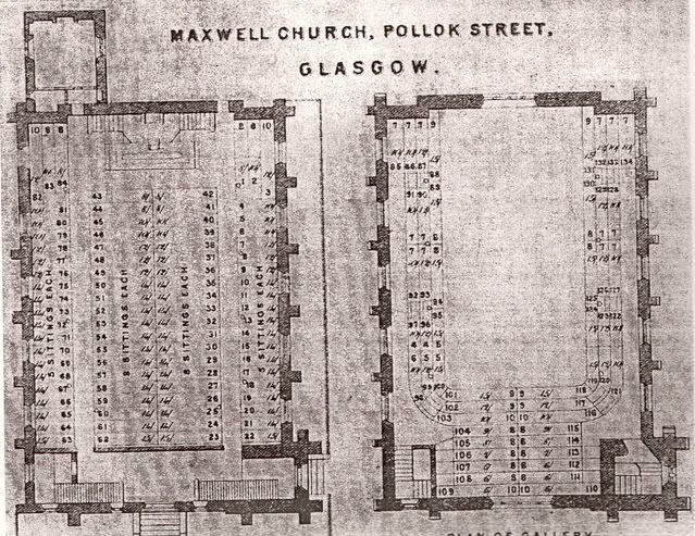
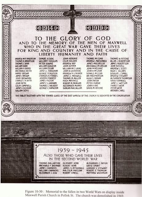
C8975 / 113 Pollok St, Maxwell Parish Church Date 25 Aug. 1966
(GH O'Donoghue, 1864-1865, demolished)
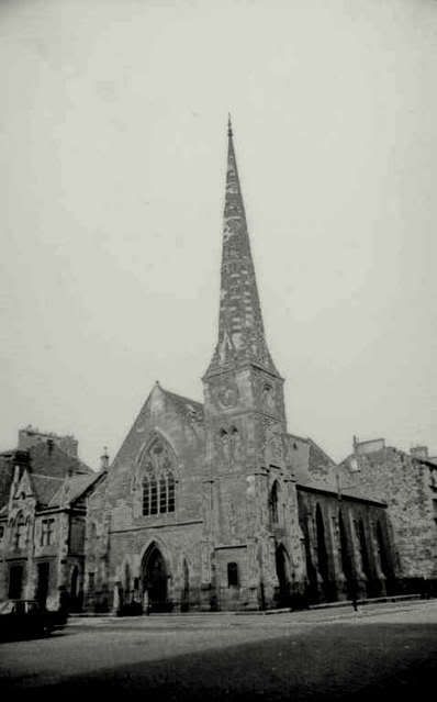
C8976 / 5 Pollok St, Pollok St UP Church Date 25 Aug. 1966 (JD Peddie, 1855-1856, demolished)
Here is an earlier photo of the church:
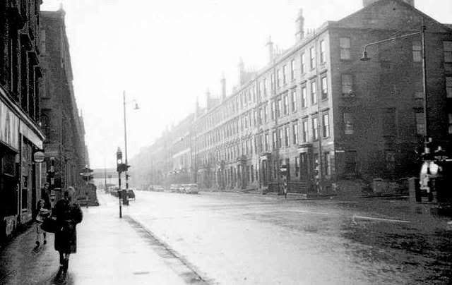
Pollok Street United Presbyterian Church on Pollok Street, off Paisley Road in Kinning Park, 1875.
The church was dedicated in 1856 and in 1900 became Pollok Street United Free. The congregation united with Plantation as Plantation St Andrew's Parish Church in 1975, and it subsequently became part of Kinning Park Parish.
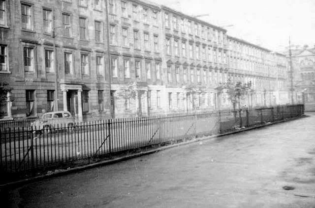
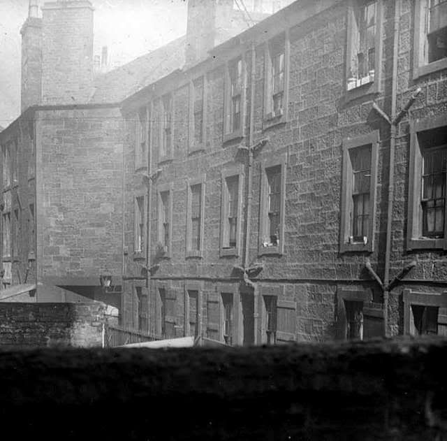
The VM also produced this typical view of the back courts of Pollok St:
C2477 / 45 Pollok St, slum housing, back lands c.1925
Were these the last remnants of the Pollok St. gardens? Middle left. (or were they a tad further west)
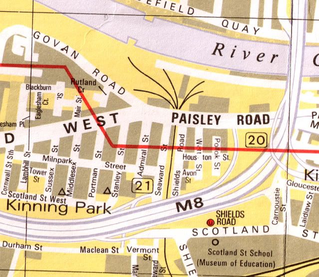
Here is what was left of Pollok St. in 1987 (Bartholomew)
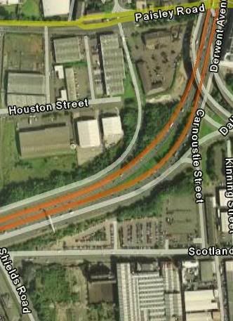
And the latest view from Google Earth, two pieces remain, one part just in front of Scotland St. School & the other running north from Houston St.
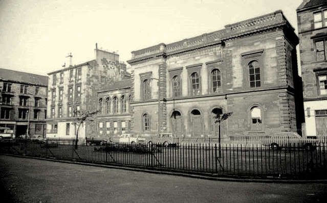
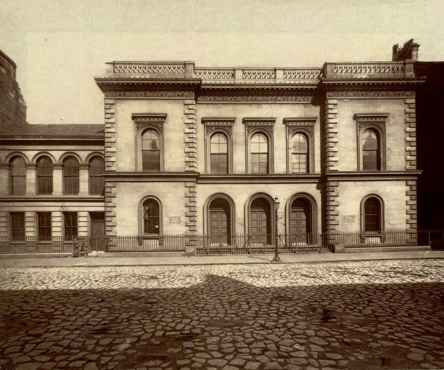
Hopefully some of you will have information to add, & some photo's of what now remains would be very welcome. Can anyone identify the large building on Paisley Rd. West that is facing onto Pollok St. in the aerial photo?
Some historical notes on the area from:
Glimpses of Old Glasgow
A great and radical change has taken place in the appearance of Kingston district. Scattered and few were the habitations either for rich or poor. In summer the trees waved their green branches over the grassy sward, and in autumn fine apple and pear frees yielded good supplies of fruit. South from Paisley Road there stood apart two handsome self contained houses inhabited by Glasgow merchants, on the enclosed ground in front of which were sheepfolds.
The late Bailie Pearson was the first to erect villas in Kingston, and succeeding in this enterprise others followed, and good substantial dwelling-houses were erected, and speedily let. In this way the district lost its rural appearance. Street after street was opened; the population greatly increased, and stores for the sale of various kinds of merchandise sprang up. In the western part of Kingston, fronting Paisley Road, nearly seventy years since, there was built Roseneath Cottage, which in external appearance was more Swiss-like than Scottish. This house was then considered a long way out of Glasgow, and many made it the end of their western walk. Its surroundings so pleasantly laid out made this old-time "tea"-garden very popular. The cottage is still in existence. Nearly opposite it on the roadside was a quaint-looking house, from the roof of which there rose up a spire-like tree. At the side of this habitation was Kinning House Burn, which in its meandering divided Lanarkshire and Renfrewshire, and poured its waters into the Clyde.
At the west of Kingston stood the Windmill Croft, which was said to be the property of the Boyles of Kelburn, and to give the title of Earl of Glasgow to the head of that family. The ground was purchased by the Clyde Trust for £40,000, and formed into a tidal dock, with a water area of 5 1/3 acres, the quays extending to 830 lineal yards, which gives accommodation for 11,000 tons of shipping. The depth of water at full flow of spring tides is 21 to 23 feet, and at low water 10 to 12 feet. It was called Kingston Dock, was the first in Glasgow, and was opened on 10th October, 1867. The total cost was £155,000. The swing bridge to it is on the lattice girder principle. Its span is 82½ feet, and it has on each side two lines of roadway for passengers and carts respectively. The bridge cost upwards of £12,000.
KINNING PARK. - This small suburb lies close to Kingston, and was constituted a burgh on 16th January, 1871. In my early days it was a truly beautiful rural spot, away from the smoke and stir of the city. The Kinninghouse Burn, formerly called the Mile Burn or Shiels Burn, was a sweet purling stream that meandered through arcadian groves down to the river. The opening of the Kingston Docks on 10th October, 1867, and the extension of the harbour brought trade and commerce to this place, and 1894 sees within its boundaries large engineering works, iron foundries, mills, and many other important industries. It is anticipated that in a few years this burgh will seek to form part of Greater Glasgow.
West of the Kinning House Burn, however - that is west and south of Pollok Street - there were nothing but corn-fields and trees, except a few villas. Some of the best coursing in the county was to be got where Pollokshields now stands, and indeed right down to the Paisley Road.