Page 1 of 1
Breadalbane Street - Anderston

Posted:
Mon Oct 09, 2006 4:27 pmby bearsontoor
Hiya,
Does anyone have any old photos of the above or indeed can you advise me where I might find these.
I know that the street was demolished (70's?) for new build and all that is left is the street name sign, on a street light pole, while all around appears not to have been touched.
Any help would be most appreciated, its where I was born and I have many happy memories as most of my family, aunts, uncles and granny lived there as well.
Trust this is appropriate for this forum.
Regards.
Alan.
Re: Breadalbane Street - Anderston
Posted:
Mon Oct 09, 2006 4:44 pmby red_kola
All I can find right now:
http://www.theglasgowstory.com/image.php?inum=TGSD00533
A wee bit of the street does remain with Bannisters (?) pub on the corner of it and St Vincent Street. Perhaps some kind person with a SCRAN login might be able to find something more ...?

Breadalbane St
Posted:
Wed Oct 18, 2006 12:21 pmby pwh60_2
Hi,
Try Yahoo groups (kentrd) - it's a group for those interested in Kent Rd Primary School - and the places they lived in - no doubt you'll meet some old neighbours, and there are plenty photos of the area.
Did you call Breadalbane St Breadalb-i-ane St too?
Pete
Posted:
Wed Oct 18, 2006 1:34 pmby red_kola
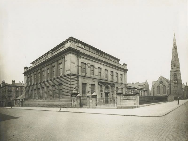
Beautiful building it was too...
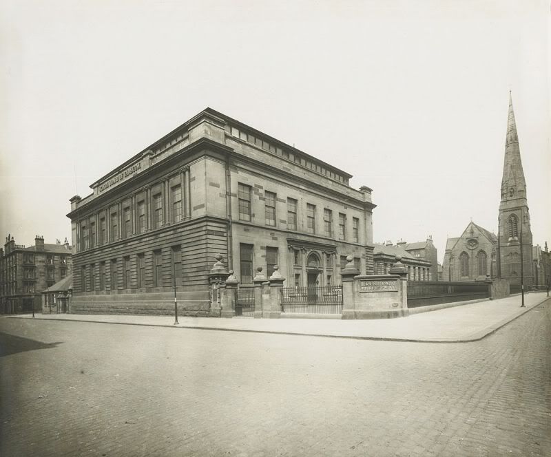
I've tried a few times to do a Past Present with this shot but it just can't be done (and the results would be too depressing anyway).
Posted:
Wed Oct 18, 2006 4:57 pmby Fossil
red_kola wrote:Beautiful building it was too...
I've tried a few times to do a Past Present with this shot but it just can't be done (and the results would be too depressing anyway).
No please do it Red cola - lets just see how bad it really is
Posted:
Thu Oct 19, 2006 1:55 pmby pwh60_2
Great photo - first shot of the old school I've seen without the lorry parked outside!
Bit of useless information - this is the Kent Rd view, gate on the left is the boy's gate beside the janitor's house, gate on the right is the girl's gate, and for the first time I've noticed the smaller building at the back - the infant's school on Berekeley St.
Pete
Posted:
Fri Oct 20, 2006 11:45 amby red_kola
Modern Fossil wrote:No please do it Red cola - lets just see how bad it really is
Please don't do one of your overlays on this one as you'll see I'm a few feet out

Posted:
Fri Oct 20, 2006 12:22 pmby red_kola
pwh60_2 wrote:Bit of useless information - this is the Kent Rd view, gate on the left is the boy's gate beside the janitor's house, gate on the right is the girl's gate, and for the first time I've noticed the smaller building at the back - the infant's school on Berekeley St.
The Janitors house was beautiful. Here's another pic:
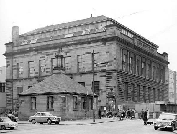
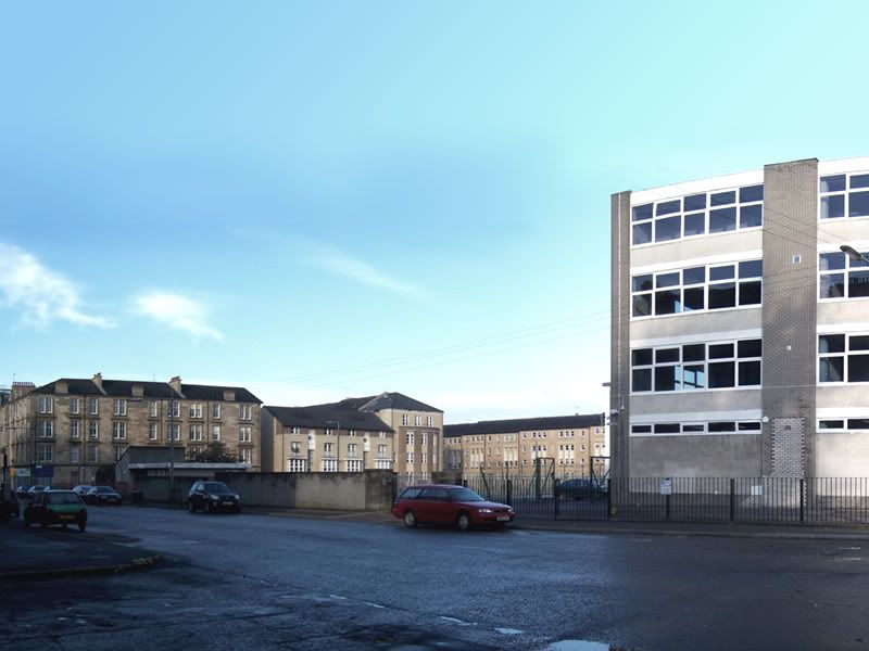
What I've only just noticed is that Woodside Secondary School appears to have been built around the earlier school whilst it was still in situ. You can see the main building on the right and the swimming pool block (itself now demolished) on the left. So they cleared this lovely building to make way for a playground? Now I'm even more depressed...

Posted:
Sat Oct 21, 2006 7:06 pmby pwh60_2
Fantastic photo.
cheers
Pete
Posted:
Sun Oct 22, 2006 11:13 amby duck
What number did you live in? My grandfather and his family lived there at number 18 at the beginning of the century ( 20th that is, of course!) I had a look on Scran but nothing I'm afraid and nothing on Virtual Mitchell either.
Posted:
Sun Oct 22, 2006 8:50 pmby onyirtodd
My recollection is that the school was bounded on the east by Claremont Street, as opposed to Breadalbane Street. The picture showing the Congregational (?) church, now the Henry Wood Hall, would seem to support this.
I also recall that the Infants Department to the rear of the site housed the junior secondary domestic science classrooms on the lower floor, level with the rear playground.
Posted:
Sun Oct 22, 2006 9:12 pmby red_kola
onyirtodd wrote:My recollection is that the school was bounded on the east by Claremont Street, as opposed to Breadalbane Street.
Indeed it does. This thread has gone slightly off-topic; mea culpa, and I apologise for that, I should have made this clear. I was also wrong earlier about the pub Bannisters which is a the south end of Claremont Street also.
There is still one tenement close at the St Vincent Street end of Breadalbane street and a newbuild block on the site of Sandyford UP Church, but all of the west side of Breadalbane St and all of it north of Dover Street has indeed vanished.
Posted:
Sun Oct 22, 2006 9:34 pmby onyirtodd
red_kola wrote:onyirtodd wrote:My recollection is that the school was bounded on the east by Claremont Street, as opposed to Breadalbane Street.
Indeed it does. This thread has gone slightly off-topic; mea culpa, and I apologise for that, I should have made this clear. I was also wrong earlier about the pub Bannisters which is a the south end of Claremont Street also.
There is still one tenement close at the St Vincent Street end of Breadalbane street and a newbuild block on the site of Sandyford UP Church, but all of the west side of Breadalbane St and all of it north of Dover Street has indeed vanished.
This
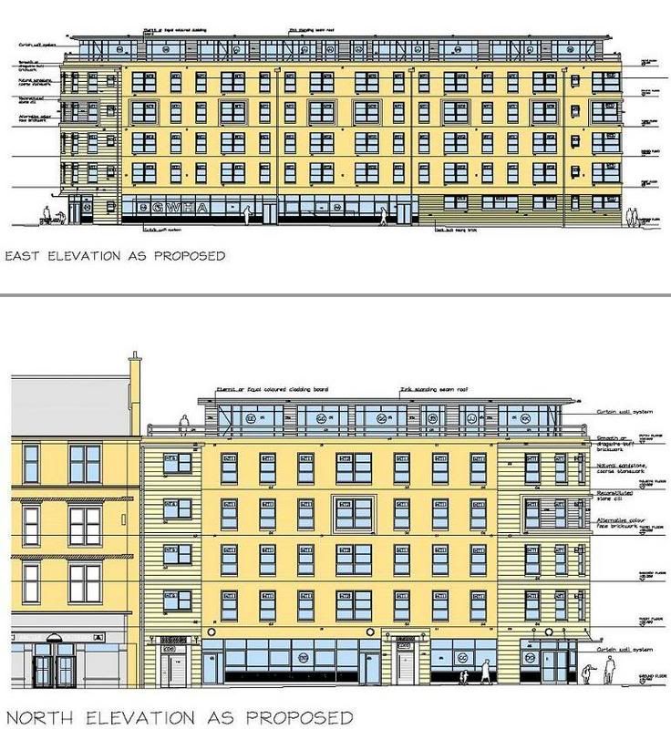
is the current proposal for the St Vincent/ Breadalbane/ wee Dover St site.