Ravenscraig

Moderators: John, Sharon, Fossil, Lucky Poet, crusty_bint, Jazza, dazza

Postby Alycidon » Mon Jan 15, 2007 7:38 am

onyirtodd wrote:Mention of Whifflet reminded me of R B Tennant in Coatbridge and helped me to track this down.

http://www.jhowie.f9.co.uk/whifflet2.htm


....err - thats my website!!! It is needing a revision though, I have acquired loads of stuff that I have not uploaded yet. Please use the front door - http://www.lowlandlocomotives.co.uk Always willing to answer questions on my specialised subject, the history of the railways of Coatbridge and Airdrie
[img]http://www.jhowie.force9.co.uk/emu314carcream.gif[/img]

We must perform a Quirkafleeg!!!!
User avatar
Alycidon
Third Stripe
Third Stripe
 
Posts: 1047
Joined: Mon Apr 18, 2005 11:11 am
Location: Eaglesham

Postby MacotheIsles » Mon Jan 15, 2007 10:17 am

:D

Brilliant website Alicydon. Thank you.
MacotheIsles
Third Stripe
Third Stripe
 
Posts: 1160
Joined: Wed Apr 05, 2006 8:24 pm

Postby MacotheIsles » Thu Jul 19, 2007 10:29 pm

As you may know development of the Ravenscraig site has been going on in earnest for several months now and the site is largely ploughed up. However, the section below the Western edge of the Steelworks vast tundra still has the odd relic or two. The River Calder flowed underneath the site in a huge tunnel and this emerged into a series of ancillary facilities designed to catch pollution that had escaped into the ground water. I was out and about tonight looking at the old sluice gates. These were designed to divert the main flow out of the natural river bed and into a diversion channel and pollution lagoons. At one time the lagoons were planted with fast growing reeds which would ingest pollutants making them easy to dispose of. It's all derelict now of course and even this entire area- which lies a good 80-100 feet below the main site at the foot of a steep railway embankment is seeing bore holes and earth moving trucks as it is prepared for the Industrial Zone, so these last few rusting remnants probably won't be arround too much longer either...


Pic 1 - Sluice from the Northern side.

Image


Pic 2 - Sluice showing the wooden gates still intact, but winding wire missing.

Image


Pic 3: Sluice from the Southern side. This is an island between the natural river course and the artificial diversion channel which is now largely overgrown.

Image


Pic 4: Winding gear at Northern side. This simply tightened/ loosened the pulley wire attached to the hoops on each gate. It appearrs that both gates could be independently operated.

Image


Pic 5: Winding gear on the island


Image


Pic 6: Manufacturer's plate on the winding gear

Image


Pic 7: This is the 'bridge' where the diversion channel rejoins the main flow at the other end of the system, some 100yds from the sluices. The water still smells oily and unclean sometimes.

Image
MacotheIsles
Third Stripe
Third Stripe
 
Posts: 1160
Joined: Wed Apr 05, 2006 8:24 pm

Postby DickyHart » Fri Jul 20, 2007 1:41 am

well found sir, and ace research
Is this gonna be a standup fight, sir, or another bughunt?
User avatar
DickyHart
Third Stripe
Third Stripe
 
Posts: 1505
Joined: Thu Feb 12, 2004 6:30 pm
Location: Carstairs

Postby MacotheIsles » Fri Jul 20, 2007 9:41 pm

Thank you Mr Hart!
MacotheIsles
Third Stripe
Third Stripe
 
Posts: 1160
Joined: Wed Apr 05, 2006 8:24 pm

Postby MacotheIsles » Fri Jul 27, 2007 10:42 pm

More pics of the site taken over the past few days.

This is the tunnel where the Calder emerges from under the site. The river is about 14 feet wide here so the tunnel must be around 18 feet tall. The pipe emerging here looks like it was lagged so I assume it carried hot water from the cooling operations?

Image


Another shot of the tunnel:

Image


There are the remains of other works at the mouth of the tunnel. Notably a large outflow under a concrete walkway with mesh gates, and this 4 foot diameter pipe. Although you cann't see it it bends down at the end to river-level. I suspect this was a siphon rather than an outflow, due to its shape and size. If so it would have helped suck river water into the reed beds when the downstream sluice was closed, shown in the next pic...

Image

Image


The sluice gates are just approx 100yds from the tunnel...

Image


and these were protected from large detrius by this rail barrier:

Image
MacotheIsles
Third Stripe
Third Stripe
 
Posts: 1160
Joined: Wed Apr 05, 2006 8:24 pm

Postby scotty » Sat Sep 01, 2007 11:06 pm

Hi,

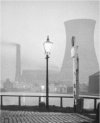
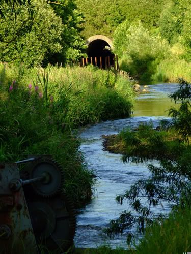
Been watching the redevelopment with some interest, got some pics as well to share. Had a wee look over at the Craigenuke end where the power station is, which by the way is still very much alive and wired in!

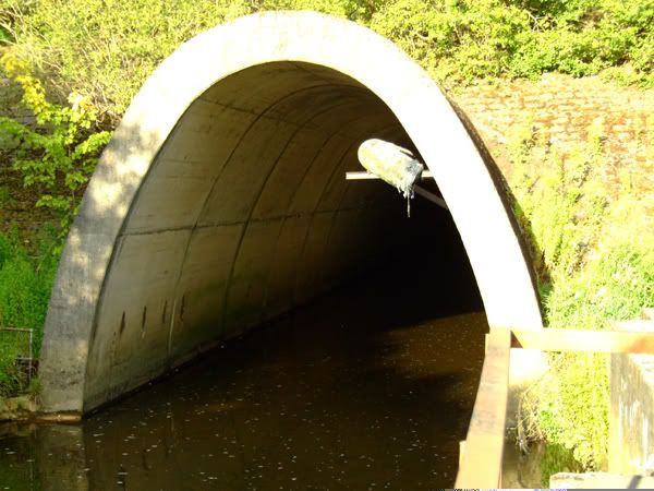
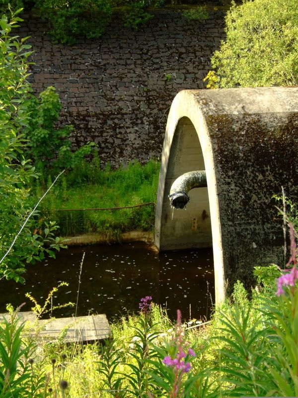
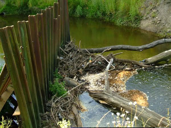
Whats also odd is that the site is also still plumbed into the sewer system as well, as I could hear water rushing under the drains as I walked over them. I'm guessing there's a fair bit of work involved in this part for the redevelopment to get the power and sewage sorted out.

Anyone had a look at http://maps.live.com
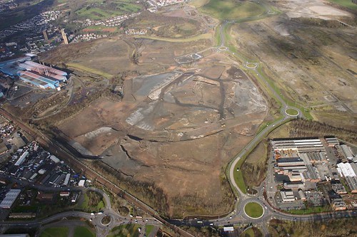
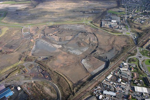
The satelite pics are about 5 - 7 years old and are superb quality. You can see a clear picture of the outline of Ravenscraig on the concrete slab thats left. Because the pics are older there are a lot of sites such as RB Tennant and Mossend which still show on the sat pics, but which of course have now been demolished.

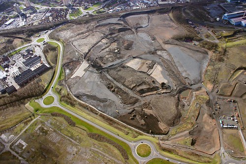
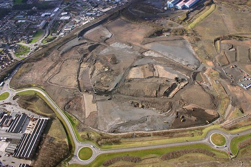
Here's the Revenscraig stuff, got more if anyones interested. Apologies if these are a bit too big for the post! I only just signed up to Photobucket so I could post them, no doubt there's a clever way to get them resized!

Mac, I've been over exploring that part near Calder park as well. Check it out on the maps.live.com site, its totally clear of any vegetation!

Vlad, there's a book you can buy for about £4 from the Motherwell Heritage Centre, it's got some good pitures of Ravenscraig in it.

Here's the power substation, taken through the fence.

Image

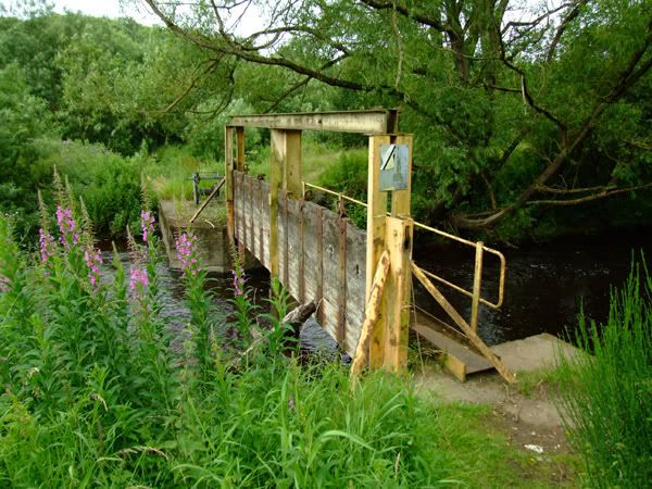
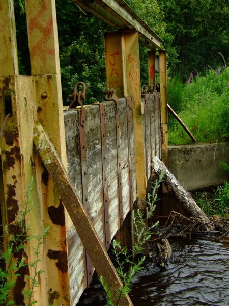
This next picture is look from the entrance bridge to the right is where the famous gas holders and cooling towers once stood. You can just see a kind of double streetlight pole to the far left, i've seen pictures taken from the gas holders looking at this area, and its all nice neat grass and well kept flower beds!

Image

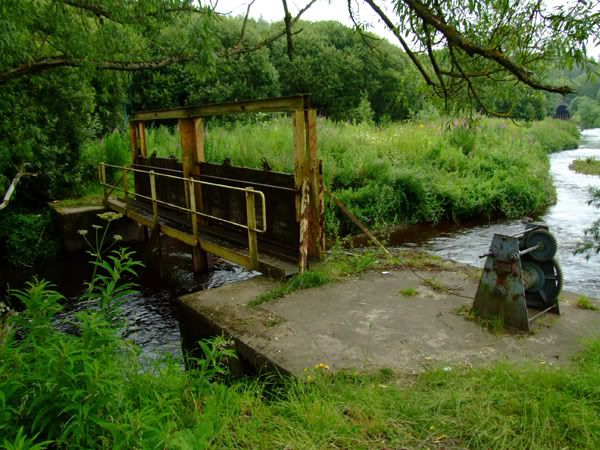
Here's a shot looking directly at where the gas holder used to stand. You can see the circular bases is still clear of growth.

Image

Finally here's one taken from Prospect hill looking at the red rail bridge that crosses over Merry Street. You can see how much land has been removed, the actuall rail embankment (and rails!) ends just to the left of that drilling machine. You can just see the bridge above the tree growth.

Image


Ravenscraig, already long dead, murdered by the Tories and BSC's Black Bob.....

Image
Scott
scotty
Busy bunny
Busy bunny
 
Posts: 33
Joined: Sun Aug 12, 2007 12:18 am

Postby zoidberg » Sun Sep 02, 2007 12:11 pm

Some really cool photos there Scott
User avatar
zoidberg
Second Stripe
Second Stripe
 
Posts: 180
Joined: Tue Jul 03, 2007 7:56 am
Location: Bexley

Postby scotty » Sun Sep 02, 2007 10:05 pm

Glad you liked them!

I also found the resize button on Photobucket, so pictures are a bit more acceptable size wise for posting now. :-)

I've got some more of the admin building just before it got pulled down in April. I don't know if you've ever seen pictures of 'the last shift' but you will recognise the gatehouse and the building from them.

I'll upload them and post them up.
Scott
scotty
Busy bunny
Busy bunny
 
Posts: 33
Joined: Sun Aug 12, 2007 12:18 am

Postby MacotheIsles » Sun Sep 23, 2007 5:20 pm

Scotty!...

Just saw this. Good pics: thank you for posting them. Was up there again today and the reconstruction continues apace with areas that had gone back to nature now being cleared yet again. Interestingly enough they seem to be installing yet further anti-pollution features down by the Calder. Not sure why they're doing this now unless the redevelopment may potentially disturb some things. I believe they are indeed finding contamination as they dig. Apparently the pollutants include arsenic, cadmium and aromatic hydrocarbons.
MacotheIsles
Third Stripe
Third Stripe
 
Posts: 1160
Joined: Wed Apr 05, 2006 8:24 pm

Postby engineer » Sun Sep 23, 2007 8:23 pm

some aerials from 2005
Image

Image

Image

Image
User avatar
engineer
Third Stripe
Third Stripe
 
Posts: 790
Joined: Fri Apr 08, 2005 9:33 pm
Location: media quarter

Re: Ravenscraig

Postby scotty » Mon Oct 22, 2007 10:07 am

Cheers Mac, I took a walk down Calder park and had a look round at the sluice gates and reed beds from your pictures. Amazing how much of a difference a month or so makes, as it was a lot more overgrown looking when I was there in August!

The land has been bought by different people, which is why the Craigneuk end is almost untouched. It's apparently been bought by some Glasgow millionaire who's planning houses. They have recently reconnected the mains water and ran a new pipe in through the gatehouse road.

While I remember, there’s a book called Out of the Furnace by Matthew Hume, it has some good pictures of Ravenscraig and other local works in it. £3.99 from the Heritage Centre. Think that Matthew Hume is also the manager of Summerlee Heritage park in Coatbridge. Most of the images in the book came from a photo shoot done by a local photographer, Owen’s of Wishaw. Motherwell Heritage centre have all those pictures, and they are good quality.


Here's some more pictures from my grim adventures! Beena while but i've had problems with cookies and my laptop, so couldn't get logged into the site. Most of these pictures were taken back in April apart from about two of them. Again apologies for the large size, i'll change this on Photobucket when I get a minute.

The Gasholders and cooling towers used to tower over this
Image

Image

Image
Image

From what i've been told this was the security building, the admin building was the one to the left.

Image

This picture was taken in August, as you can see the plastic security shelter has been ripped up and is lying in the carpark behind the fence!
Image

Image
Image

Cheers
Scott
Scott
scotty
Busy bunny
Busy bunny
 
Posts: 33
Joined: Sun Aug 12, 2007 12:18 am

Re: Ravenscraig

Postby MacotheIsles » Mon Oct 22, 2007 9:40 pm

Scott! Good stuff again.

Was also looking at Engineer's aeriel shots and it's strange to remember that flat plain to the north of the actual buildings (strip mill, furnaces, etc) was a river valley until the Seventies (can't remember exactly when). It was gradually filled in - I suppose with clinker and other byproducts of the work - until it was level and the Calder culverted. It's well worth a look at the 1950s (57 I think) map of the areaa in the Heritage Centre Reference Room.

Was talking to an old boy who's worked in one of the other works predating Ravenscraig and he was telling me about the work that had to be done to extinguish smouldering mines and release poisonous gasses on the site before work could start on The Big Mill itself. In short I can well imagine there's a long-term toxic cocktail still lurking in deep places, brewed by the effluent from generations of industry there.

As far as current development goes here at the Jerviston end we're being treated to the massed percussion band of two giant cranes that spend their entire day hoisting massive concrete slabs skywards, then dropping them onto the ground like bombs every 45 seconds. Boom! Booom! I don't know whether they're flattening the ground acre by slow acre or just punching deep holes in it, but the novelty has worn off.
MacotheIsles
Third Stripe
Third Stripe
 
Posts: 1160
Joined: Wed Apr 05, 2006 8:24 pm

Re: Ravenscraig

Postby scotty » Wed Oct 24, 2007 9:31 am

Mac,
The pollution is a bit of a worry, when you think that they are billing the site as the new town centre! I'd imagine the houses there will be hot property as well, not quite the next Bothwell but you can bet they will probably sell most of them before they even get built 8O

I've got a B&W pic of the area taken by the RAF around WW1 time which still shows the 'Dig for Victory' vegetable patches when it was a greenfield site! I think I can see the valley on that. I'm guessing the part of the valley thats still there is the bit they call the Ravenscraig Gorge?

Just looking at your pics of the Calder tunnel at the Calder park end, makes you wonder where the other end of that pipe is, or what other pipework is still lurking and possibly feeding into the river.

Whatever happens it will be interesting to see what they actually do at the Craigenuke end with all the bridges, still seem in good condition as I saw them driving JCB's and heavy machinery over them. The power station still supplies Dalziel works, and I wonder what they will do to the Merry Street bridge at the 'Well Wash. Cycle track possibly? Thats what they did with a lot of the Caledonian Railway thats no longer used.
Scott
scotty
Busy bunny
Busy bunny
 
Posts: 33
Joined: Sun Aug 12, 2007 12:18 am

Re: Ravenscraig

Postby scotty » Wed Jan 16, 2008 1:08 am

Been a while since I posted, had problem with my logon, or laptop and cookies again. Anyway, knew that it was only a matter of time before this showed up on YouTube. Isn't the interweb great!! This poseted on 6th Jan.

http://uk.youtube.com/watch?v=bTnewAyj5xU

Vlad thing this is what you've been looking for. The Heriatge have pictures which they kindly allowed me to scan with my laptop / usb scanner. But they made me swear I wouldn't post them online :roll: They do show how many people where there that day with cameras, and yes you see the cameraman panning round at one point and just about everybody is armed with cameras!!

Good video, but at the same time sad, I suppose at the time of the toer demolition the works were in advanced stages of being dismantled, 1996? So suppose they were merley blowing up the tombstone of the Scottish Steel industry.

Do a search for Bethleheme Steel on YouTube if you want to see how Ravenscraig might have looked in opperation. Coru alo have a few training videos on there all about blast furnace and sinter. As you will probably see Bethlehem Steel met the same fate as Ravenscraig, GoldenSands are turning the Belthlehem site into a casino.

Work has started at the Craigenuke end on the new Motherwell college as well.

Cheers
Scott
Scott
scotty
Busy bunny
Busy bunny
 
Posts: 33
Joined: Sun Aug 12, 2007 12:18 am

PreviousNext

Return to Glasgow Chat (Coffee Lounge)

Who is online

Users browsing this forum: No registered users and 156 guests