Page 5 of 9

PostPosted: Mon Apr 03, 2006 6:10 pm
by gordon
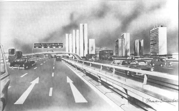
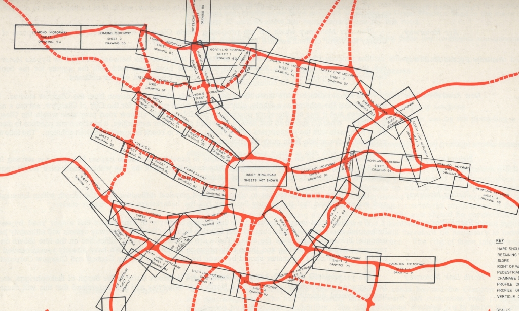
wow....not sure whats more worrying.....what they did end up building, or what they actually had planned!

Scary stuff, but quite cool in a Blade Runner-ish metropolis way.

PostPosted: Mon Apr 03, 2006 6:11 pm
by james73
My Kitten wrote:Found this one

http://hc110-2.blogspot.com/


Love this one - people sitting about reading papers under motorway flyovers. ::):

This area shown *was* built and is under the M8 at Castle Street. It's a concrete
shithole/hellhole.

Image

Image


James H

PostPosted: Tue Apr 04, 2006 8:17 am
by motman
Nice one Kitten. Brings back memories. What could have happened indeed had the planners got their way. :twisted:

PostPosted: Sun Feb 11, 2007 11:40 am
by Fraz13
Never seen this thread before but at least they were close with 1 of the "artists impressions"

Image

Image

PostPosted: Wed Feb 21, 2007 12:35 pm
by neilmc
North Street at Argyle Street, looking north to St. Vincent Street and Charing Cross, 1971:-
Image
Sorry about dust and scratches; just re-discovered this old 35mm neg. I'm sure I took other photos around the same location that day, and will look into this.

PostPosted: Wed Feb 21, 2007 12:39 pm
by My Kitten
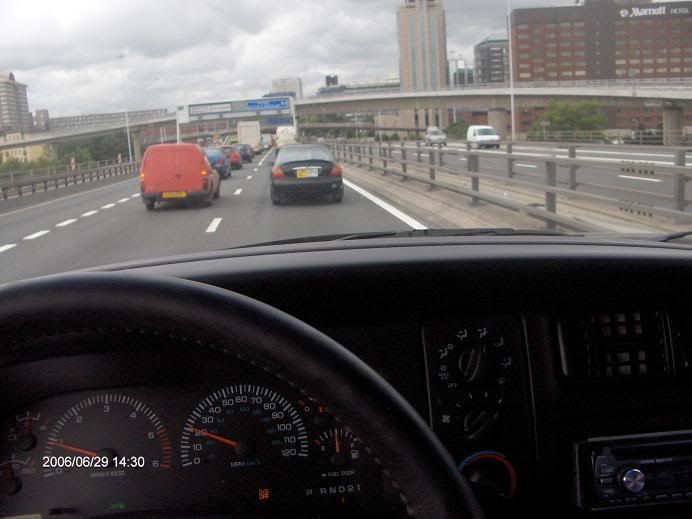
neilmc wrote:North Street at Argyle Street, looking north to St. Vincent Street and Charing Cross, 1971:-
Image
Sorry about dust and scratches; just re-discovered this old 35mm neg. I'm sure I took other photos around the same location that day, and will look into this.


Would be good if you could neilmc, it looks clean!!

PostPosted: Thu Feb 22, 2007 12:08 am
by gordon
Aye.....hasn't it aged well?

PostPosted: Thu Feb 22, 2007 7:57 am
by Alycidon
Love the map, pity the site doesn't go into more detail as to where the motorway shown heading north around Port Dundas was meant to go, I have always wondered about the unfinished slip roads here,

PostPosted: Thu Feb 22, 2007 3:12 pm
by nodrog
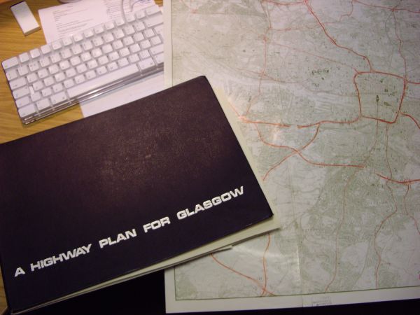
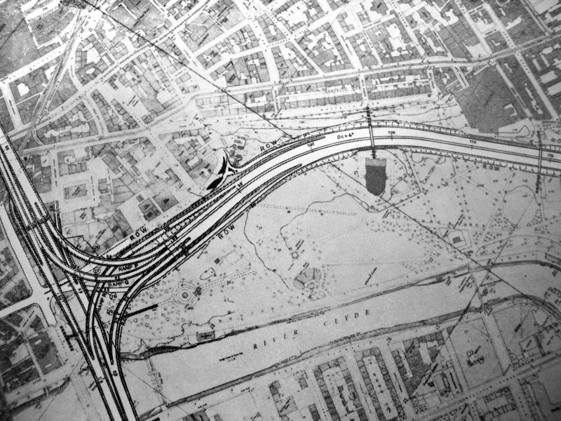
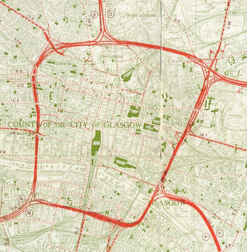
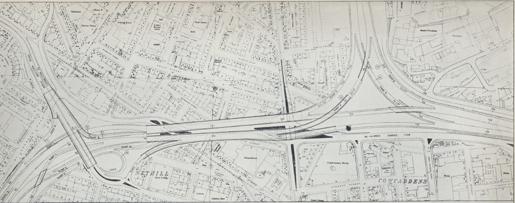
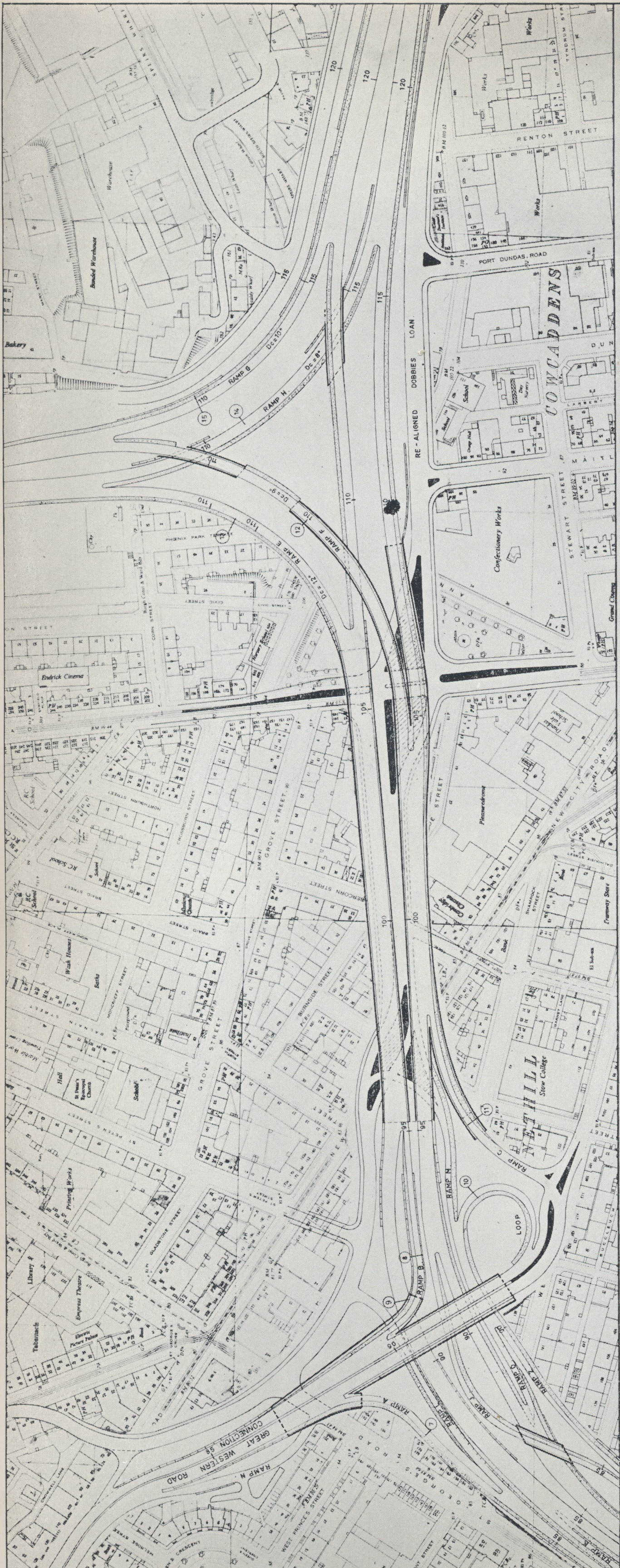
motman wrote:The book that contained all of this stuff was called 'A Highway Plan for Glasgow' by Scott, Wilson and Kirkpatrick, consulting engineers, around the mid 60s. I remember borrowing it from the Uni library on Oakfield Avenue when doing a geography project at Hillhead in the late 60s to make little models of the Kingston Bridge and the CharingX trench. The 2 things that scared me the most (an engineer in the making at 17?) was the umpteen lane highway from the Kingston Bridge to the M77/M8 junction, and the M74 junction on stilts above Glasgow Green: I never thought that they would happen, but lo! the M77 did years later, the other has now been reinvented further south.

The Great Western Road plans were indeed scary - a souped up Clydeside Expressway.


Right, inspired by your post, I went to the Uni library this afternoon and checked this book out. It's pretty damn comprehensive with detailed maps and plans of all the sections. There are lots of tables of traffic figures etc as well.

Image

The pages in it are (a) falling apart, and (b) annoyingly just too large to fit in my scanner.

However, if there are sections people are especially interested in seeing in detail, let me know and I'll see what I can do.

For example, here's a section on Glasgow Green. See how it sweeps majestically past the People's Palace...

Image

Nodrog

PostPosted: Thu Feb 22, 2007 3:46 pm
by james73
Kwality. I'd be interested in seeing more of the eastern and southern flanks as
well as the north section that was to travel along the path of the Forht & Clyde
canal.


James H

PostPosted: Thu Feb 22, 2007 3:50 pm
by red_kola
Now I see the cover I remember checking that out years ago.

Remind me Nodrog, is that the publication which also contains the artists renditions of what they wanted to do to Great Western Road (ie: make it look not unlike the Clydeside Expressway - even between St Georges X and Byres Rd)?

PostPosted: Thu Feb 22, 2007 4:05 pm
by nodrog
here's the index sheet to the detailed plans; if you can tell me the drawing numbers you want to see in detail, it'd make life much easier!

Image

Image

Kola: I've not seen any artists impressions for the GWR section; but the plans for it are there and discussed in some detail in the text.

I noticed there was another book in the library, from a couple of years earlier, which was an 'Interim report' into the highway plans from the same bunch of architects. I'll have a look at it next time I'm passing and see if those artist impressions are in there...

PostPosted: Thu Feb 22, 2007 4:15 pm
by nodrog
Junction with the north section at the F&C Canal:

Image

Hi-res version here.

PostPosted: Thu Feb 22, 2007 10:02 pm
by My Kitten
excellent stuff Nodrog :)

PostPosted: Thu Feb 22, 2007 10:08 pm
by glasgowken
Fantastic maps :) Was the motorway to plough through Glasgow Green ? It's the first time i've realised that.

Just missing the People's Palace 8O Shocking.