Hi,
Im new to HG and love the forum, my hobby is photography and I love to go to different places and try and find the history or areas.
Recently I was looking at Google Map and seen something I found a little strange
http://maps.google.co.uk/maps?f=q&hl=en&q=Erskine&ie=UTF8&z=17&ll=55.903415,-4.436342&spn=0.00436,0.013561&t=k&om=1
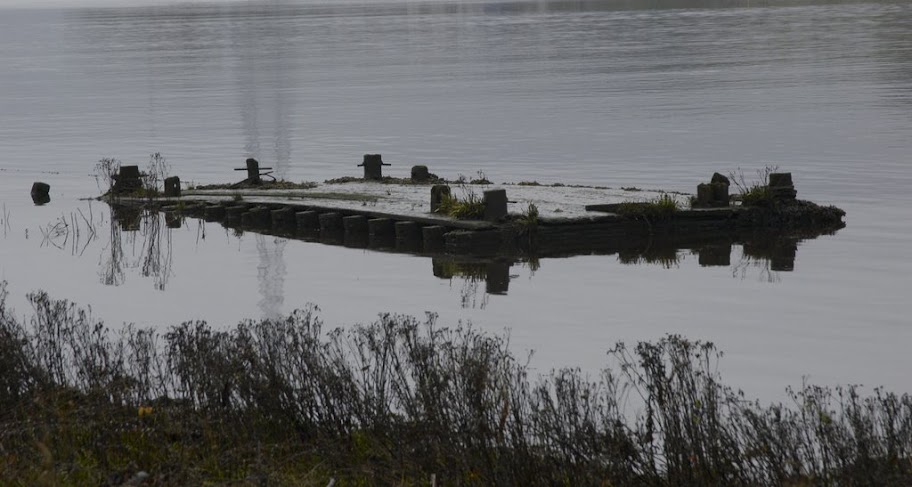
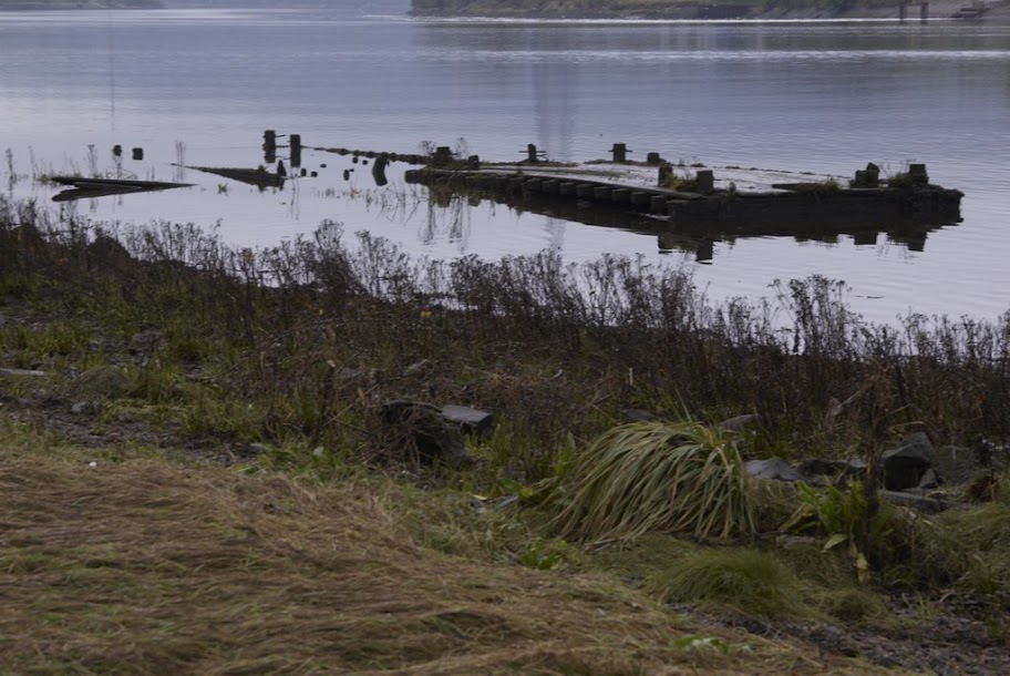
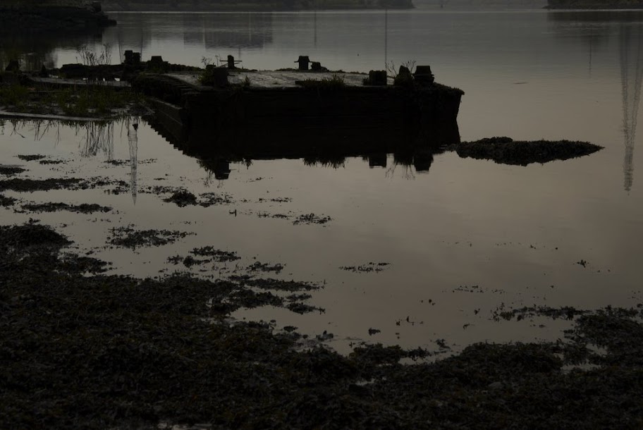
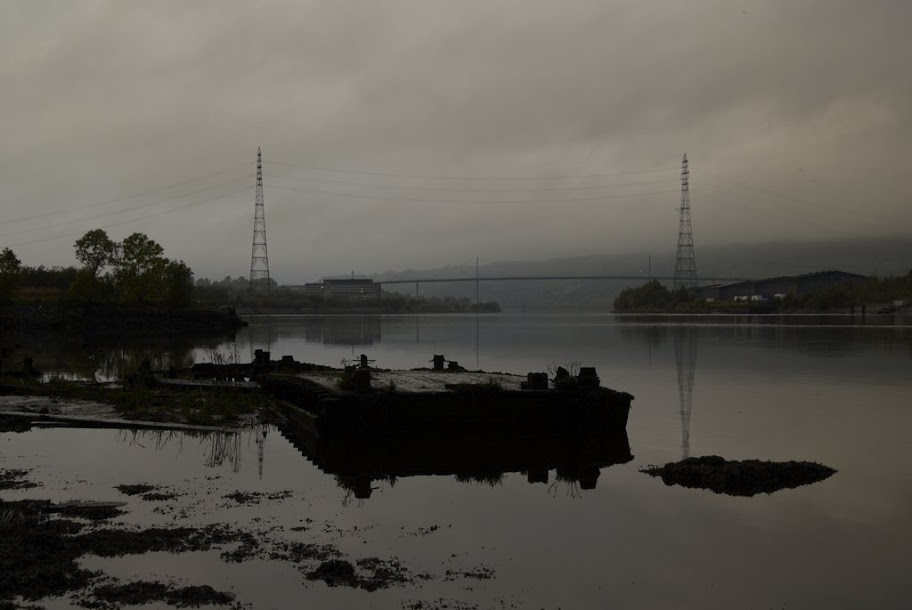
There seems to be a lot of what I thought might be barges or boats, not sure if this been covered in the forum, did a search but found nothing, so I decided to take a wander down and see.
I couldnt get round to the area shown with lots of them in the estuary and the tide was still not out fully but I did see about 4 of them near the slipway shown. They appeared to be large old wooden barges, very bad repair and on the riverbed.
Also I could see one towards the mouth of a river that looked as though it might have been even larger, with metal struts perhaps showing it was once more than one level. Couldnt get close to it. I couldnt see the boat like structure as the tide was still not out fully.
I plan on going back soon with better light and a lower tide.
Just wandering if anyone on here had more information?
I put some photos here and some are selected below.
http://picasaweb.google.com/tommygraham/Erskine
http://lh3.google.com/tommygraham/RT6WH ... imgmax=912
http://lh5.google.com/tommygraham/RT6WI ... imgmax=912
http://lh4.google.com/tommygraham/RT6WK ... imgmax=912
http://lh5.google.com/tommygraham/RT6WL ... imgmax=912
http://lh5.google.com/tommygraham/RT6WM ... imgmax=912
http://lh6.google.com/tommygraham/RT6WN ... imgmax=912
http://lh6.google.com/tommygraham/RT6WP ... imgmax=912
// copy and paste the links
The Hidden Glasgow Forums
To post in the forums you will need to first register. All new members are welcomed, with one caveat: You must behave and be nice AND SEARCH BEFORE POSTING!
Erskine Harbour and Barges?
Moderators: John, Sharon, Fossil, Lucky Poet, crusty_bint, Jazza, dazza
10 posts
• Page 1 of 1
![]() by HollowHorn » Tue Oct 24, 2006 11:18 pm
by HollowHorn » Tue Oct 24, 2006 11:18 pm
There are a dozen or so Mud Punts lying there, from a fleet of around 350 in use by the Clyde Trust by 1870. Some were still in use in the early '60s.
They basicaly carried dredged mud from the from Clyde out to the dumping grounds such as Newshot Island. The punts were 30ft long and each could carry around 10 tons of material.
Thanks to Roy Smart (Friends of the Glenlee) for the above.
They basicaly carried dredged mud from the from Clyde out to the dumping grounds such as Newshot Island. The punts were 30ft long and each could carry around 10 tons of material.
Thanks to Roy Smart (Friends of the Glenlee) for the above.
-

HollowHorn - Third Stripe

- Posts: 8921
- Joined: Mon May 23, 2005 9:59 pm
- Location: Paisley
![]() by Uggyy » Tue Oct 24, 2006 11:25 pm
by Uggyy » Tue Oct 24, 2006 11:25 pm
Superb, there still lots left there you can easy see from the pathway they have put on that part of the Clyde.
Is the boat that you can see on Google part of the same thing?
Ive been looking about that area and there lots of history in that area. From roman coins to a possible viking dugout
http://www.scapetrust.org/pdf/Clyde_Bute/Clyde_map5.pdf
I know that up at the old Erskine slipway for the ferry there used to be a harbour with the remains of a ship from the Spanish Armada used as a prison ship. I can remmber seeing the remains of the hull when I was very young. I tried to find it last year with no luck.
Great area of the Clyde.
All the Best,
Tommy
Tommy
- Uggyy
- Just settling in

- Posts: 6
- Joined: Tue Oct 10, 2006 12:50 am
![]() by Peekay » Wed Oct 25, 2006 12:01 am
by Peekay » Wed Oct 25, 2006 12:01 am
HollowHorn wrote:There are a dozen or so Mud Punts lying there, from a fleet of around 350 in use by the Clyde Trust by 1870. Some were still in use in the early '60s.
They basicaly carried dredged mud from the from Clyde out to the dumping grounds such as Newshot Island. The punts were 30ft long and each could carry around 10 tons of material.
Thanks to Roy Smart (Friends of the Glenlee) for the above.
There's a bucket dredger called the Greenock sits just off Largs. There used to be 3 of the same spec built by Simons in Renfrew (1876'ish) to work the Clyde, the other two called Port Glasgow and Gourock. The Greenock went to Davy Jones locker in 1902 and IIRC the other two shared similar fates eventually but have yet to be found. The Greenock had mines placed round it during WW2 as it's position was ideal for U-boats to sit in the shadow and not get picked up on Sonar.
PK
PS-I should add that's taken from "Clyde Shipwrecks" by Peter Moir. Good book
-

Peekay - Third Stripe
- Posts: 1021
- Joined: Sun May 14, 2006 12:55 pm
![]() by Peekay » Wed Oct 25, 2006 12:35 am
by Peekay » Wed Oct 25, 2006 12:35 am
Uggyy wrote:Thats interesting, after reading that I looked up google for it and found out the two mines where actualy detonated in only 1996
Scary thought.
Tommy
For some reason every so often Mines pop up at Finnart oil terminal. Must be a tidal/current thing. The Navy removes them rather sharpish though. The Clyde is still absolutely hoaching with WW2 munitions. Dredgers and Trawlers lift stuff up all the time and dump it at an Island which shall remain nameless. Tons of boy-toys though! I know loads of Glasgow garages that have "articles" in them, the legality of which is somewhat questionable
Pk
-
Peekay - Third Stripe
- Posts: 1021
- Joined: Sun May 14, 2006 12:55 pm
![]() by Uggyy » Wed Oct 25, 2006 1:23 am
by Uggyy » Wed Oct 25, 2006 1:23 am
Easy to get too?
Just reading a bit of history from that area,
http://www.inchinnan.org.uk/history/people/jimmy_monson.htm
very interesting and even shows this might be a crater from an old german landmine !
http://maps.google.co.uk/maps?f=q&hl=en ... 9&t=k&om=1
Time for a revisit soon, this time when the tides out more...
All the Best,
Tommy
Tommy
- Uggyy
- Just settling in
- Posts: 6
- Joined: Tue Oct 10, 2006 12:50 am
![]() by adoniram » Mon Sep 10, 2007 2:59 pm
by adoniram » Mon Sep 10, 2007 2:59 pm
Erskine Inchinnan and Bishopton is literally riddled with remains from the bronze age,roman times,viking times and even earlier.
Crannogs have been found at the old Ferry and across the water at Old kilpatrick/Balloch area.
Always remember the old farmer (Mitchell?) forever finding roman artefacts and pottery etc and calling them a "nuisance" as he couldn't plough the fields properly.
Quite a few unexploded bombs were found in the area and the golf course has a couple of huge craters from the blitz.
Knights templar artefacts and graves are in abundance in Inchinnan.The original church which was demolished in 68/69??? to make way for the airport still has the old templar graves.
You can still get access but you have to get permission from Glasgow Airport.
Erskine itself was a goldmine of old buildings and fancy mansion houses that have unfortunately been demolished and alas nothing remains.
The Erskine beach area if i recall correctly was where a few boats had been found washed up dating back hundreds of years.
An area rich in history if you know where to look.
- adoniram
- Busy bunny

- Posts: 10
- Joined: Tue Sep 27, 2005 11:21 am
- Location: Glasgow
![]() by HollowHorn » Mon Sep 10, 2007 9:23 pm
by HollowHorn » Mon Sep 10, 2007 9:23 pm
Here is the article from the 'Friends of the Glenlee' mag that I quoted at the beginning of this thread (ain't scanners wonderful)

-
HollowHorn - Third Stripe
- Posts: 8921
- Joined: Mon May 23, 2005 9:59 pm
- Location: Paisley
10 posts
• Page 1 of 1
Return to Hidden Glasgow Projects
Who is online
Users browsing this forum: No registered users and 69 guests