Skypark makes sense..what was that originally..I have a distant memory of it being a tyre factory..Dunlop or something (that may be complete nonsense). Although I had thought it was older than the early 70's.
The Anderston Centre was never industrial just housing and retail..remember McOnomy. I seem to remember it was like some kind of proto-Argos.
The Hidden Glasgow Forums
To post in the forums you will need to first register. All new members are welcomed, with one caveat: You must behave and be nice AND SEARCH BEFORE POSTING!
Glasgow Highway Plans - c1965
Moderators: John, Sharon, Fossil, Lucky Poet, crusty_bint, Jazza, dazza
29 posts
• Page 2 of 2 • 1, 2
![]() by AlanM » Tue Mar 14, 2006 10:01 am
by AlanM » Tue Mar 14, 2006 10:01 am
It was also the original home of Radio Clyde. (the Anderston Centre that is)
Last edited by AlanM on Tue Mar 14, 2006 2:01 pm, edited 1 time in total.
Who needs a six pack....when you've got a keg!!!

-

AlanM - Third Stripe

- Posts: 1827
- Joined: Wed Sep 07, 2005 8:59 am
- Location: Knightswood
![]() by AMcD » Tue Mar 14, 2006 11:11 am
by AMcD » Tue Mar 14, 2006 11:11 am
According to Scran...
Clydeway Industrial Centre was commissioned in 1963, designed 1963-4, and built 1965-9 to designs by architects Jack Holmes & Partners. This megastructure allows vehicle access to three levels of the complex, which was intended to provide premises for industries displaced by the surrounding Comprehensive Development Area (CDA).
Brick-clad blocks divided by bands of metal-framed windows and pale brick band courses. The tall towers between the blocks contain fire stairs. This massive structure provides over 46450 sq m of space for factories and warehouses.
-

AMcD - Third Stripe
- Posts: 684
- Joined: Tue Mar 02, 2004 9:19 am
- Location: Kilmarnock

![]() by gordon » Tue Mar 14, 2006 11:56 pm
by gordon » Tue Mar 14, 2006 11:56 pm
Its funny, the original Skypark was so overstructured they were able to fire a couple more floors on top of it without any trouble, i think that happened in the 80s (but i could be wrong)....before they dipped it in the silver paint.....absolute nightmare walking past that thing on the way home from work when the sun was shining!
-

gordon - Second Stripe

- Posts: 364
- Joined: Sun Jul 17, 2005 1:19 am
- Location: Lenzie
Re: Glasgow Highway Plans - c1965
![]() by Jupiter-Returns » Wed Mar 15, 2006 4:04 am
by Jupiter-Returns » Wed Mar 15, 2006 4:04 am
The Voyageur wrote:In the 60's, a set of plans were drawn up for the route of the highway system in and around Glasgow by Scott Wilson Kirkpatrick and Partners.
Here are those plans (in no particular order):
http://images3.fotopic.net/?iid=y49ts4& ... quality=70
http://images4.fotopic.net/?iid=y49tsg& ... quality=70
http://images5.fotopic.net/?iid=y49tsh& ... quality=70
http://images2.fotopic.net/?iid=y49tsx& ... quality=70
http://images3.fotopic.net/?iid=y49tsj& ... quality=70
http://images1.fotopic.net/?iid=y49tsi& ... quality=70
http://images4.fotopic.net/?iid=y49tsk& ... quality=70
http://images1.fotopic.net/?iid=y49tsm& ... quality=70
http://images2.fotopic.net/?iid=y49tsn& ... quality=70
http://images3.fotopic.net/?iid=y49tsp& ... quality=70
http://images5.fotopic.net/?iid=y49tsl& ... quality=70
http://images5.fotopic.net/?iid=y49tsq& ... quality=70
http://images4.fotopic.net/?iid=y49tso& ... quality=70
Neat pics!
Far cry from this eh.

"Ma kin ah dae a jobby?" Jobbies, jobbies are funny a bit.
-

Jupiter-Returns - Second Stripe
- Posts: 264
- Joined: Fri Mar 10, 2006 2:08 am
- Location: Area 51
![]() by Fat Cat » Wed Mar 15, 2006 4:34 pm
by Fat Cat » Wed Mar 15, 2006 4:34 pm
HollowHorn wrote:Found this on Flicker, save & magnify for an interesting wee read.
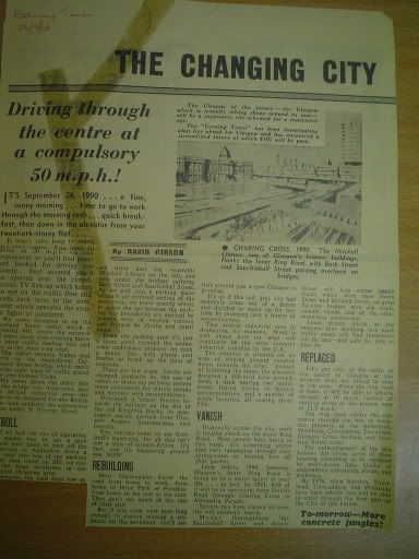
Traffic will "whistle through at 50 pm instead of the current 13.5 mph"
They know how to live the in the fast lane then, eh?
I'll take the 13.5 mph please, a damn site faster than at present anyway.
-

Fat Cat - Third Stripe
- Posts: 840
- Joined: Wed Feb 09, 2005 3:09 pm
- Location: Glasgow
![]() by swavmcav » Wed Mar 15, 2006 11:33 pm
by swavmcav » Wed Mar 15, 2006 11:33 pm
That settles it then. Skypark it is. I had no idea it was to accomodate companies uprooted by the surrounding destruction. I had thought it was a single indsutrial site originally.
The additional floors were only added a few years ago when it metomorphosed from being just plain old business centre to a "skypark".
It was a monumental brick and concrete industrial behemoth before the glass cladding was added, with lots of layers like the garage sets I used to play with when I was a kid. I liked it like that. I see they are now cladding the lower floors too. I guess it'll be all reflective glass before long.
In saying that the place is incredibly succesful now. Chock full of companies. Plasma screens on every wall. Costa coffee bar in the foyer.
Nice.
Well better than my work anyway.
- swavmcav
- Busy bunny

- Posts: 34
- Joined: Mon Jan 09, 2006 11:17 am
![]() by gordon » Sun Jul 02, 2006 7:01 pm
by gordon » Sun Jul 02, 2006 7:01 pm
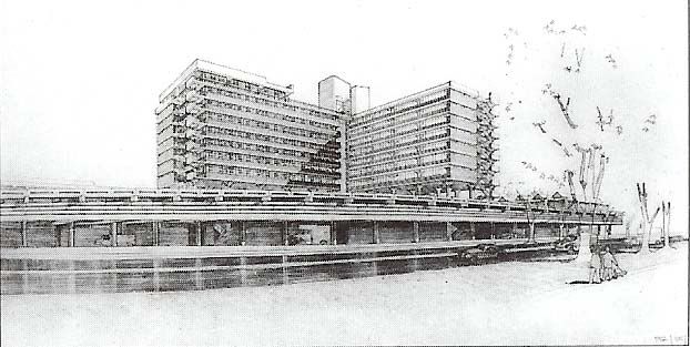
So where exactly was the anderston centre then? I can't quite picture any of it, with the exception of the high flats. I work reasonably close to there (Finnieston), but don't have a scoob where the shopping precinct etc used to be!
Alternatively, im just being thick.
Alternatively, im just being thick.
-
gordon - Second Stripe
- Posts: 364
- Joined: Sun Jul 17, 2005 1:19 am
- Location: Lenzie
![]() by red_kola » Sun Jul 02, 2006 7:23 pm
by red_kola » Sun Jul 02, 2006 7:23 pm
gordon wrote:So where exactly was the anderston centre then? I can't quite picture any of it, with the exception of the high flats. I work reasonably close to there (Finnieston), but don't have a scoob where the shopping precinct etc used to be!
Closer to town - other side of M8 from Finnieston - and pretty much underneath the high flats just off Argyle Street behind the Hilton and next to the Mariat.
It was a bus station as well although that bit has completely disappeared with the development of Cadogan Square. There was a HG thread about it here.
Destroy All Monsters
-

red_kola - Third Stripe
- Posts: 1350
- Joined: Mon Apr 12, 2004 11:05 am
![]() by gordon » Sun Jul 02, 2006 9:03 pm
by gordon » Sun Jul 02, 2006 9:03 pm
Yeah, i know roughly where it is now....have vague memories of picking up snowboarding equipment before a trip to Glenshee from some kind of warehouse under one of the high-rises (the one immediately beside the Holiday Inn), that wasn't too long ago right enough, maybe 95/96.
-
gordon - Second Stripe
- Posts: 364
- Joined: Sun Jul 17, 2005 1:19 am
- Location: Lenzie
![]() by scynthius726 » Sun Jun 17, 2007 6:41 pm
by scynthius726 » Sun Jun 17, 2007 6:41 pm
*bump*
See here for an exceptionally well-written and interesting study on the Glasgow Highway plans.
See here for an exceptionally well-written and interesting study on the Glasgow Highway plans.
-

scynthius726 - Just settling in

- Posts: 8
- Joined: Wed Nov 08, 2006 1:26 pm
- Location: East Kilbride


![]() by Delmont St Xavier » Thu Jun 21, 2007 3:07 pm
by Delmont St Xavier » Thu Jun 21, 2007 3:07 pm
Neither can I. All I see is 'No access or something about Direct Linking.'
"Listen, it's too big a world to be in competition with everyone. The only person who I have to be better than is myself. And in your case, that's enough."
- Delmont St Xavier
- Third Stripe
- Posts: 726
- Joined: Wed Dec 20, 2006 10:04 am
29 posts
• Page 2 of 2 • 1, 2
Return to Hidden Glasgow Projects
Who is online
Users browsing this forum: No registered users and 20 guests