Page 78 of 88

Posted:
Wed Jan 17, 2007 12:47 pmby glasgowken
Awkward bastard this one, houses have been built on the original vantage point, but I think this is close.
Drumchapel 1910

Drumchapel 2007

Posted:
Wed Jan 17, 2007 1:01 pmby glasgowken
Another awkward one as the original location wasn't exact. I studied an old OS map to match up the farm buildings and am 95% sure

Drumry Road 1940

Drumry Road 2007

Posted:
Wed Jan 17, 2007 1:15 pmby My Kitten
gooduns gk:)
Posted:
Wed Jan 17, 2007 1:21 pmby glasgowken
Cheers

Posted:
Wed Jan 17, 2007 1:25 pmby Timchilli
(apologies for shiteness - these are both screengrabs from videos)
St. George's Cross, 1922
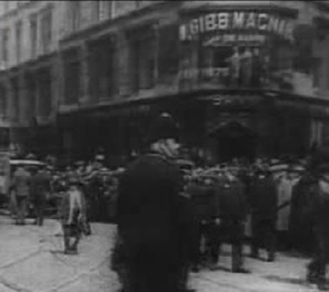 St. George's Cross, 1998
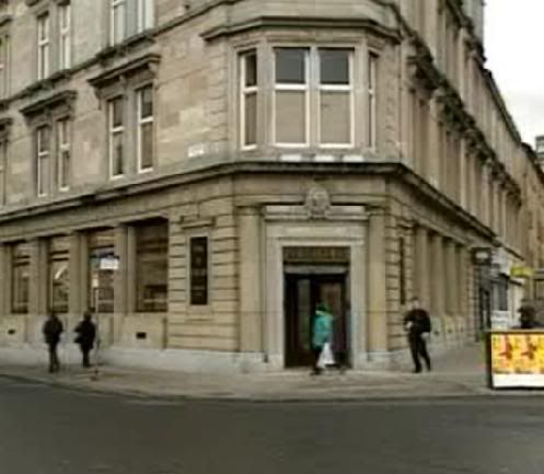
Tim
Posted:
Fri Jan 19, 2007 12:23 pmby Timchilli
crusty_bint wrote:St Vincent St, tenement and church
Anyone know what the second Parthenon-style building (the one now replaced by the hideous former BP building) in this photo was?
Tim
Posted:
Fri Jan 19, 2007 4:09 pmby glasgowken
According to a 1913 OS map, it was the Union Church.
Posted:
Fri Jan 19, 2007 4:17 pmby The Voyageur
Going back a bit earlier to 1892-1894:

Posted:
Fri Jan 19, 2007 4:51 pmby Timchilli
Thanks for that, GK & Voyageur.
Glad the Council got rid of those unsightly buildings to make way for today's shite.
Tim
Posted:
Fri Jan 19, 2007 6:45 pmby YokerBloke
Bothwell Circus, I like the sound of that. Pity they pissed it away with the M8
Posted:
Fri Jan 19, 2007 8:41 pmby Armadillo
It actually survived the building of the M8, and was done away with sometime after. It would appear from the pic and the map that it was elevated above that other wee street.

Posted:
Sat Jan 20, 2007 12:00 pmby gordon
what sort of date is that photo from?
Took me ages to work out what was going on!
Posted:
Sat Jan 20, 2007 12:31 pmby YokerBloke
Me too!
Then I realised where Dalian house would eventually be built!
It's funny to see the Bothwell St off ramp so 'exposed'
Excellent shot!

Posted:
Sat Jan 20, 2007 1:14 pmby gordon
Its quite strange as well, looking at the old map, the way the streets around there break from the grid pattern (Bothwell Circus and the other one running diagonally) - its still pretty central.
Posted:
Sat Jan 20, 2007 4:51 pmby glasgowken
gordon wrote:what sort of date is that photo from?
Took me ages to work out what was going on!
Mid 1970's.